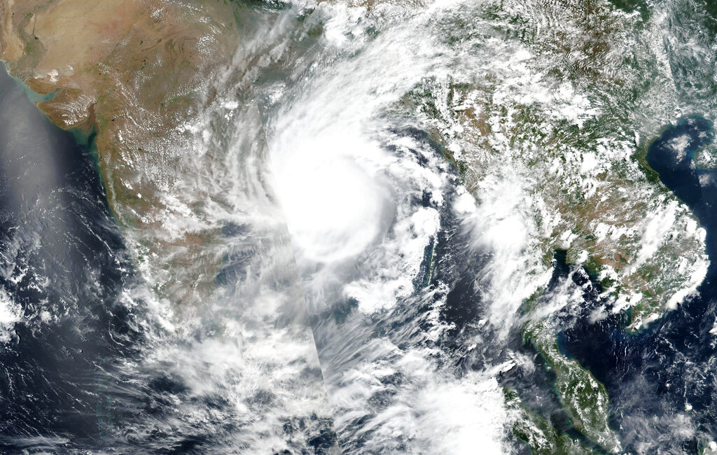
NASA has released a satellite image of cyclone Amphan over the Bay of Bengal. Amphan is expected to make landfall on Wednesday afternoon, and forecasters warned of extensive damage from high winds, heavy rainfall, tidal waves and some flooding in crowded cities like Kolkata. It is the second super cyclone on record that has formed over the Bay of Bengal, said Mrutyunjay Mohapatra, IMD chief. The first was a devastating 1999 cyclone in Odisha state that left nearly 10,000 people dead.
Location of the Cyclone
- 125 KM NEARLY EAST-SOUTHEAST OF PARADIP.
- 225 KM SOUTH OF DIGHA.
- 380 KM SOUTHWEST OF KHEPUPARA (BANGLADESH)
WIND-SPEED
PARADIP-102, CHANDBALI-74, BHUBANESHWAR-37,
BALASORE-61, PURI-41 AND GOPALPUR-4 KMPH.
RAINFALL
PARADIP-208, CHANDBALI-67, BHUBANESHWAR-46.5,
BALASORE-56.5, PURI-87.0 AND GOPALPUR-8.6 MM.
