At least 30 satellite images have emerged from Galwan Valley in Eastern Ladakh, the site that witnessed a fierce clash between Indian and Chinese troops on June 15. About 20 Indian soldiers were martyred in the face-off while China, which hasn't come out clear with its count, is believed to have suffered 40 casualties including a Colonel.
The photos clearly show that China didn't cross the Line of Actual Control (LAC). The Chinese soldiers, infact, undertook some construction activity near their border, which went against the Sino-India agreement. India objected to the construction.
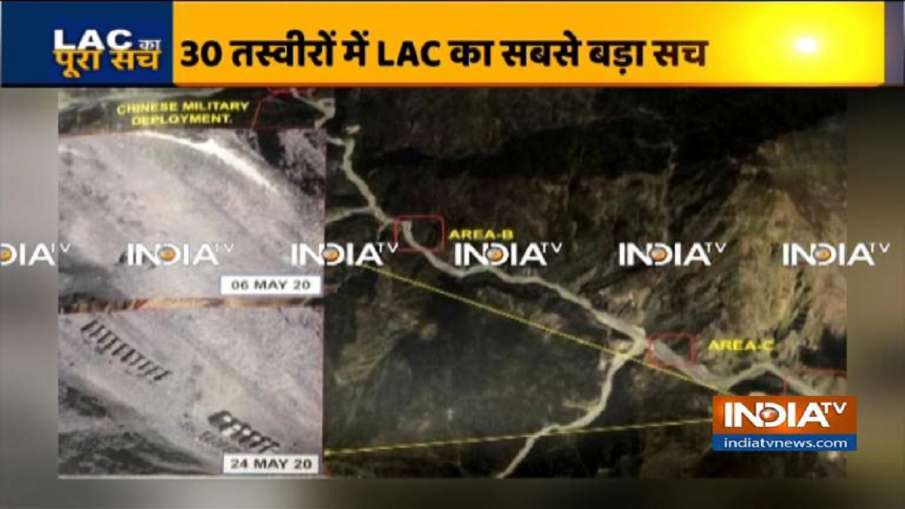
The satellite images clearly show how China indulged in construction near the LAC. China's base camp is 30 kilometers from the LAC while Indian camp is located around the LAC in Galwan Valley. It is learnt that China began laying out its plan a month before the clash. The Chinese troops took the river route to reach the LAC. On May 6, satellite images didn't show much of a change in the situation. Infact, the flow of Galwan river also appeared to be normal.
However, satellite images thereon showed increase in the number of Chinese camps along the river, obstructing its flow as well. On May 14, scenes of an almost dry Galwan river emerged. And, simultaneously the number of Chinese camps were on the rise.
Pictures from May 4 show that the Chinese PLA did come close to the LAC but never crossed it. However, it violated the agreement between India and China of any construction activity along the LAC. The satellite images clearly unravel how the Chinese soldiers dried up the river bed. When Indian troops went to raise the issue of construction, a confrontation with the Chinese PLA followed. Indian soldiers, however, managed to destroy Chinese construction.
