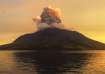
As heavy rains have affected several regions of India, several videos on social media have emerged showing a mesmerising sight of a massive 'shelf cloud' forming in the skies of Haridwar, leaving people in awe.
It should be noted that the India Meteorological Department (IMD) has issued a 'red alert' in 11 districts of Uttarakhand for Tuesday and Wednesday, including Haridwar, warning of localised flooding and landslides. The water level of river Ganga is already flowing above the danger level owing to the rain.
What are shelf clouds?
According to the US National Weather Service, a shelf cloud is described as a low, horizontal and sometimes wedge-shaped cloud that is associated with the leading edge of a thunderstorm or potentially strong winds.
Shelf clouds are also known as Arcus clouds. They are attached to the parent cloud's base and though they appear quite ominous, these clouds do not usually produce tornadoes, as per the NWS.
What are other types of clouds?
Shelf clouds are often confused with wall clouds, which the NWS describes as "localised lowering from the rain-free base of a strong thunderstorm". Unlike shelf clouds, some wall clouds exhibit strong upward motion and cyclonic rotation that produce tornadoes. These clouds rotate on a vertical axis, while shelf clouds rotate on a horizontal axis.
Scud clouds, also known as fractus clouds, are low, ragged stratiform cloud elements that are usually detached from larger thunderstorms or cloud bases. They are not dangerous by themselves.
Other types of clouds, as per the NWS, include Mammatus, clouds, which are visually described as having pouch-like protrusions from underneath larger clouds that don't produce severe weather. There are also contrail clouds, which are basically narrow, line-shaped clouds that look like jet aircraft exhaust, appearing in cold air at high altitudes.
Hole-punch clouds have a large circular gap between them and are also known as fallstreak clouds. They are formed when water temperature in the cloud is below freezing level and sections of water start to freeze, which causes the surrounding water vapour to also freeze and descend.
ALSO READ | Uttarakhand: Kedarnath Yatra stopped at Sonprayag amid heavy rainfall
ALSO READ | Uttarakhand: Three killed, several vehicles buried as rain-triggered landslide hits Uttarkashi | VIDEO