
In the next step, Geographic Information System (GIS) database is used to identify the probable crash site, Harinarayana explained.
The researchers report that their system locates a crash site "within a few seconds with good accuracy" making it more reliable and faster than the existing search-and-rescue method that relies on signals from special radio transmitters - or black boxes - carried on board airplanes.
According to Harinarayana, the new system has been successfully validated in four different cases of hypothetical plane crashes in Gujarat.
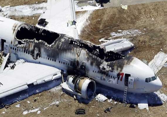
Indian scientists devise new technique to hasten rescue of air-crash victims
Gandhinagar: In a technique that could be of immense global interest, Indian scientists have devised a method to not only predict the time a plane will hit the ground after losing contact but also the
Read all the Breaking News Live on indiatvnews.com and Get Latest English News & Updates from India
Advertisement
Advertisement
-
Cyclone Arnab: ODRAF teams deployed at vulnerable locations in Odisha, vehicle movements restricted

-
PM Modi's two-day 'Chintan Shivir' with Cabinet begins today, Viksit Bharat roadmap on agenda
-
When will India's first bullet train start running? Ashwini Vaishnaw gives major update
-
India TV Chairman and Editor-in-Chief Rajat Sharma unanimously re-elected as NBDA president
-
Cyclone Arnab forming in Bay of Bengal? IMD warns deep depression to make landfall, Odisha on alert
Top News
-
Azamgarh man who shot wife, two priests and took children hostage killed in encounter; son dies too
-
US, Iran held 'very good' 3-hour meeting at UN, says Trump after threatening to 'annihilate' Tehran
-
Cyclone Arnab: ODRAF teams deployed at vulnerable locations in Odisha, vehicle movements restricted
-
Trump backs India-Middle East-Europe Corridor, calls for energy routes away from Iran
Advertisement
Advertisement