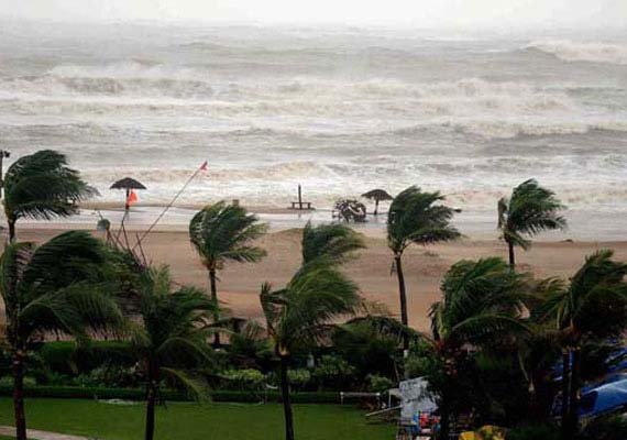
New Delhi: Cyclonic storm Hudhud will turn take a “very severe” turn in the next 12 hours, bringing with itself very heavy rainfall and gusty winds as it inches closer to the coast, the MeT department has said. In the evening, Hudhud was 675-km east-southeast of Visakhapatnam and 685-km southeast of Gopalpur, moving closer to the coast.
“The system would continue to move west-northwestwards and intensify further into a very severe cyclonic storm during the next 12 hours.
It would cross north Andhra Pradesh coast around Visakhapatnam by the forenoon of 12th (Oct.),” the Indian Meteorological Department (IMD) said in a bulletin.
The cyclone had been yesterday positioned at about 1100-km southeast of Gopalpur and 1150-km east-southeast of Visakhapatnam at around 11.30 A.M.
The Andaman & Nicobar Islands were, meanwhile, put off a state of alert as “no adverse weather” is expected due to this system over the territory.
The MeT office has issued a heavy rainfall warning for the north Andhra Pradesh coast and south Odisha.
“Under the influence of the system, rainfall at most places, with heavy (6.5-12.4-cm) to very heavy falls (12.5-24.4-cm) at a few places, and isolated extremely heavy falls (more than 24.5-cm), would occur over south Odisha from the evening of Oct. 11 onwards.
“Rainfall would occur at most places with heavy to very heavy rainfall at a few places (likely) over Visakhapatnam, Vizianagaram and Srikakulam districts of north coastal Andhra,” the bulletin said.
According to the MeT department, squally winds reaching speeds of 50-60 kmph gusting to 70 kmph would commence along and off the north Andhra Pradesh and south Odisha coasts from the morning of Oct 11.
Windspeeds would increase to 130-140 -kmph gusting to 150-kmph from Oct. 12.
“Sea condition would be rough to very rough from the morning of Oct. 11. It would gradually become phenomenal from 12th morning onwards,” the MeT said.
It also warned that, under the influence of the system, there was a threat of “extensive damage to kutcha houses, partial disruption of power and communication lines, minor disruption of rail and road traffic”.
The bulletin also cautioned against “flying debris and the flooding of escape routes”.
