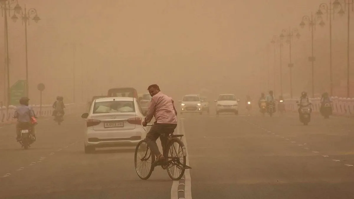
A large sandstorm is expected to impact Delhi NCR and parts of western Uttar Pradesh within the next two hours, as strong westerly surface winds continue to push dust from the Thar Desert towards the region.
Satellite imagery indicates widespread sand and haze drifting eastward. These conditions are likely to be accompanied by severe thunderstorms.
According to the information available, the sand has been lifted from the Thar Desert due to intense surface winds over Rajasthan. As the weather system moves ahead, visibility and air quality may be affected across Delhi NCR and nearby areas of West UP.
“Dust storm/followed by Thunderstorm with light rainfall/Drizzle and lightning (30-40 Km/h gusty winds) is very likely to occur at Sohana, Rewari, Nuh (Haryana) Bhiwari (Rajasthan) during next 2 hours,” IMD’s Delhi centre posted on X.
Yellow alert amid severe heatwave
Delhi continued to face severe heat, with temperatures staying much higher than usual across the city. The India Meteorological Department (IMD) reported that the maximum temperature reached 43.6°C, which is about 3.4°C above the normal level for this time of year. Night-time conditions also remained warm and uncomfortable, with the minimum temperature recorded at 28.4°C, nearly two degrees above average.
Several areas in Delhi and the National Capital Region experienced even harsher conditions during the day. The Ridge and Aya Nagar were among the hottest spots, both recording a high of 44.6°C. Other parts of the city also saw extreme heat, including Lodhi Road at 43.8°C, Palam at 43.7°C, and Safdarjung at 43.6°C.
The weather department has also issued a yellow alert for the next three days. It has warned of strong surface winds along with possible heatwave conditions during the afternoon and evening hours. Forecasts suggest that daytime temperatures may remain close to 44°C, while night temperatures could hover around 30°C.
ALSO READ: Delhi swelters under intense heat as mercury touches 43.6°C; IMD issues yellow alert for next 3 days
