North India is witnessing its wettest monsoon since 2013, with rainfall standing 21 per cent above normal so far this season. The unprecedented surge has triggered a sharp rise in “extremely heavy” rainfall events, making this August (2025) one of the most destructive in recent years.
2013 flashback: A grim benchmark
The last time the region recorded such high rainfall was in 2013, the year of the devastating Kedarnath floods. This year’s deluge has already surpassed that mark in terms of frequency of extreme downpours, raising concerns over intensifying climate patterns and disaster preparedness.
Record number of ‘extremely heavy’ rainfall episodes
According to the India Meteorological Department (IMD), till August 25, North India has logged 21 extremely heavy rain events. This marks a 50 per cent jump over last year’s record of 14 events since IMD began tracking this data in 2021.
By IMD’s definition, ‘extremely heavy’ rainfall means more than 204.5 mm in just 24 hours at a weather station. With five days left in August, the count is expected to climb further.
Why so much rain this monsoon?
IMD chief Mrutyunjay Mohapatra explained that the spike is caused by the repeated collisions of western disturbances (moving in from Central Asia) with monsoon currents from the Bay of Bengal and, at times, the Arabian Sea.
“When these systems interact over the northwestern belt, they trigger intense rainfall spells,” Mohapatra said.
Surplus rain across all months
For the first time in 12 years, North India has registered a surplus in all three monsoon months- June, July, and August.

- Current season rainfall (till August 26): 209.4 mm
- Last year’s August: 256.4 mm (wettest since 1996), but with fewer extreme rainfall events.
- On August 25 alone, the region logged 21.8 mm, nearly four times the daily normal of 5.6 mm.
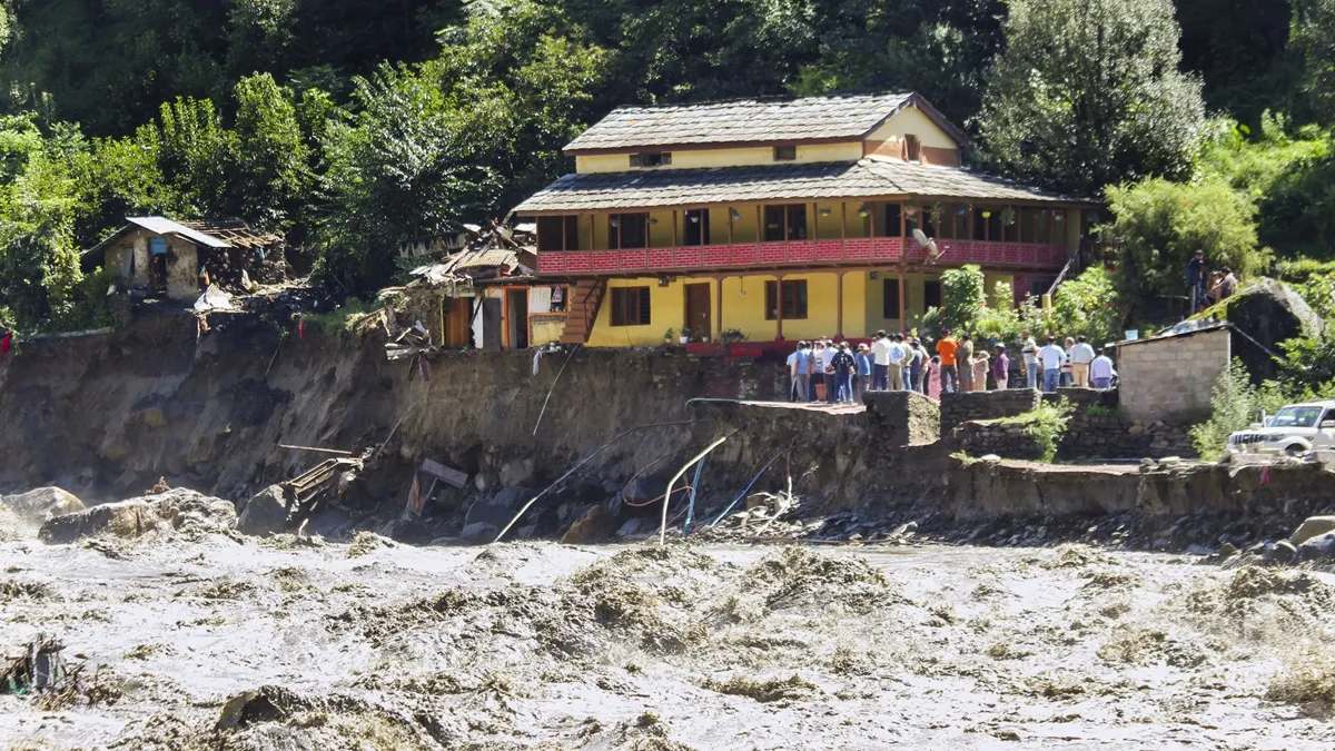
Hills bear the brunt
Data shows most extreme downpours have hammered Jammu and Kashmir, Himachal Pradesh, and Uttarakhand, where fragile hill terrain amplifies risks of floods, landslides, and infrastructure damage.
A climate warning?
Meteorologists say the current pattern of intense rainfall events, though still within seasonal averages, is a stark reminder of climate volatility. Frequent cloudbursts, flash floods, and soil erosion highlight the urgent need for better disaster management and climate-resilient infrastructure in vulnerable states.