The well-marked low-pressure area over southeast Bay of Bengal intensified into a depression on Saturday morning, laying centred around 1,100 km south of Paradip in Odisha, the MeT department said. The system, which is around 1,250 km south of Digha in West Bengal and 1,330 km south-southwest of Khepupara in Bangladesh, is likely to intensify rapidly into a cyclonic storm by Saturday evening and then into a severe cyclonic
storm during the subsequent 24 hours, Bhubaneswar Meteorological Centre Director H R Biswas said.
Thereafter, it is likely to move north-northwestwards initially till May 17 and then re-curve north-northeastwards across northwest Bay of Bengal towards West Bengal coast between May 18 and 20, he said.
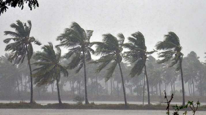
Under its impact, coastal Odisha is likely to experience light to moderate rainfall with heavy rain in isolated places in the evening of May 18 and heavy to very heavy rain at a few places on May 19, Biswas said.
He said isolated heavy rainfall is likely to occur over northern Odisha coast on May 20.
Coastal districts of Gangetic West Bengal are likely to experience light to moderate rainfall with heavy rain at a few places on May 19 and heavy to very heavy rain in some parts of the region on May 20, Biswas said.
Fishermen have been advised against venturing into deep seas due to very rough sea condition, he said.
The Odisha government has geared up to deal with a possible calamity in the midst of its fight against COVID-19, a senior official said.
In view of the IMD forecast, the state government has placed 12 coastal districts on alert and asked the collectors to arrange for alternative shelter for the people there, he said.
Though the IMD is yet to give an exact forecast about the landfall of the cyclone, the administration has braced for the impending situation and accordingly, focused on the northern coastal districts of Jagatsinghpur, Kendrapara, Bhadrak and Balasore, Special Relief Commissioner (SRC), P K Jena said.
He said plans have been made for pre-positioning of the ODRAF, NDRF and fire service personnel if the situation arises. They will rescue people likely to be affected by the probable calamity and clear roads if they get blocked.
The situation will be managed properly as Odisha has a vast experience in dealing with such situations in the past, Jena said.
"We are well prepared to deal with any situation. However, the district administrations will have the double task to manage COVID-19 outbreak along with the possible cyclone," he said.
As most of the cyclone and flood shelters and schools are now being used as temporary medical centres to quarantine returnees from different states, the collectors will keep ready other concrete buildings in their jurisdiction for housing people in their areas likely to be affected by the cyclone, the SRC said.
The district collectors have been told to ensure that temporary medical centres located within three km from the sea be shifted if required, he said.
"We have spoken to the collectors of the northern districts through video conference and apprised them of the situation. They were directed to keep the machinery ready for the impending situation," Jena said.
"If required, evacuation of people will be undertaken in view of the situation," he said.
To a query, the SRC said the collectors were told to conduct screening and tests of those lodged in the temporary medical centres in the coastal districts and allow the people testing negative for COVID-19 to be home quarantined.
Jena said all line departments have been alerted.
While the housing and urban development and panchayati raj departments have been told to ensure supply of drinking water, the energy department has been asked to be prepared for resuming power supply quickly if there is any damage due to the possible cyclone. The health department has also been asked to be ready, he said.
The IMD has forecast squally winds with speed reaching 45 to 55 kmph and gusting to 65 kmph along and off Odisha coast from May 19 morning and along and off West Bengal coast from May 19 afternoon.
The wind speed will gradually increase to 65-75 kmph from May 20 morning along and off north Odisha and West Bengal coast. It will gradually increase thereafter, it said.
Squally winds gusting to 65 kmph are likely over the Andaman Sea during the next 48 hours.
Winds gusting to 65 kmph are prevailing over southeast and adjoining southwest Bay of Bengal.
The wind speed is likely to increase to 110 kmph over east-central and adjoining west-central Bay of Bengal by the morning of May 17, it said.
The gusts are likely to increase to 145 kmph over southern parts of central Bay of Bengal by the morning of May 18 and to 180 kmph over northern parts of the central Bay of Bengal and adjoining north Bay of Bengal on May 19, it added.
ALSO READ | Cyclone Amphan: 12 Odisha districts on storm alert
ALSO READ | Advancement of monsoon over Andaman and Nicobar around May 16: IMD
