New York, March 12: The powerful earthquake that unleashed a devastating tsunami Friday appears to have moved the main island of Japan by 8 feet (2.4 meters) and shifted the Earth on its axis.
"At this point, we know that one GPS station moved (8 feet), and we have seen a map from GSI (Geospatial Information Authority) in Japan showing the pattern of shift over a large area is consistent with about that much shift of the land mass," said Kenneth Hudnut, a geophysicist with the U.S. Geological Survey (USGS).
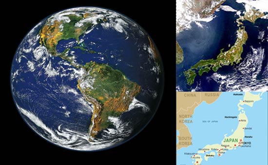
Reports from the National Institute of Geophysics and Volcanology in Italy estimated the 8.9-magnitude quake shifted the planet on its axis by nearly 4 inches (10 centimeters).
Watch Video:- 215,000 People Homeless In Japan quake
Watch Video:-Fukushima Drowned Live From Japan
Watch Video:-Explosion at a nuclear power plant in Japan
Watch Video:-Thousands In Japan Missing After Quake, Tsunami
The temblor, which struck Friday afternoon near the east coast of Japan, killed hundreds of people, caused the formation of 30-foot walls of water that swept across rice fields, engulfed entire towns, dragged houses onto highways, and tossed cars and boats like toys. Some waves reached six miles (10 kilometers) inland in Miyagi Prefecture on Japan's east coast.
The quake was the most powerful to hit the island nation in recorded history and the tsunami it unleashed traveled across the Pacific Ocean, triggering tsunami warnings and alerts for 50 countries and territories as far away as the western coasts of Canada, the U.S. and Chile. The quake triggered more than 160 aftershocks in the first 24 hours -- 141 measuring 5.0-magnitude or more.
The quake occurred as the Earth's crust ruptured along an area about 250 miles (400 kilometers) long by 100 miles (160 kilometers) wide, as tectonic plates slipped more than 18 meters, said Shengzao Chen, a USGS geophysicist.
Japan is located along the Pacific "ring of fire," an area of high seismic and volcanic activity stretching from New Zealand in the South Pacific up through Japan, across to Alaska and down the west coasts of North and South America. The quake was "hundreds of times larger" than the 2010 quake that ravaged Haiti, said Jim Gaherty of the LaMont-Doherty Earth Observatory at Columbia University.
The Japanese quake was of similar strength to the 2004 earthquake in Indonesia that triggered a tsunami that killed over 200,000 people in more than a dozen countries around the Indian Ocean. "The tsunami that it sent out was roughly comparable in terms of size," Gaherty said. "[The 2004 tsunami] happened to hit some regions that were not very prepared for tsunamis ... we didn't really have a very sophisticated tsunami warning system in the Indian Ocean basin at the time so the damage was significantly worse."
The Japanese quake comes just weeks after a 6.3-magnitude earthquake struck Christchurch on February 22, toppling historic buildings and killing more than 150 people. The timeframe of the two quakes have raised questions whether the two incidents are related, but experts say the distance between the two incidents makes that unlikely.
"I would think the connection is very slim," said Prof. Stephan Grilli, ocean engineering professor at the University of Rhode Island.
Though the affect is very small but it can change many things on minute level. Satellite communication and Launching may be affected. The researchers said that while the minuscule change may be completely undetectable, it still illustrates the punch behind the Japan's massive earthquake. Last year a 8.8-magnitude earthquake shifted the globe's axis by about 10 centimetres that hit Chile resulting into shortened days by 1.26 millionths of a second.
Shifting of plates or land masses is not a new thing. Today what we see different continents in the world map is actually a result of tectonic plates movement due to earthquakes and volcanic eruptions, there was a single continent earlier, all the present continents and land masses were together millions of years ago.
Although imperceptible to humans, days will be a tiny bit shorter after Friday's magnitude 8.9 earthquake off the coast of Japan.
NASA geophysicist Richard Gross calculated that the Earth's rotation accelerated by 1.6 microseconds because of the shift in mass caused by the massive quake -- the fifth strongest since 1900.
That change in rotation speed is slightly more than the one caused by last year's earthquake in Chile. However, an even larger earthquake in Sumatra in 2004 caused a 6.8-microsecond shortening of the day, the Associated Press reported.
